
Seagrass monitoring survey and seabed mapping will take place in Dale Bay from 8th October 2025 to 10th October 2025 by RV Lady Gail II and a USV.
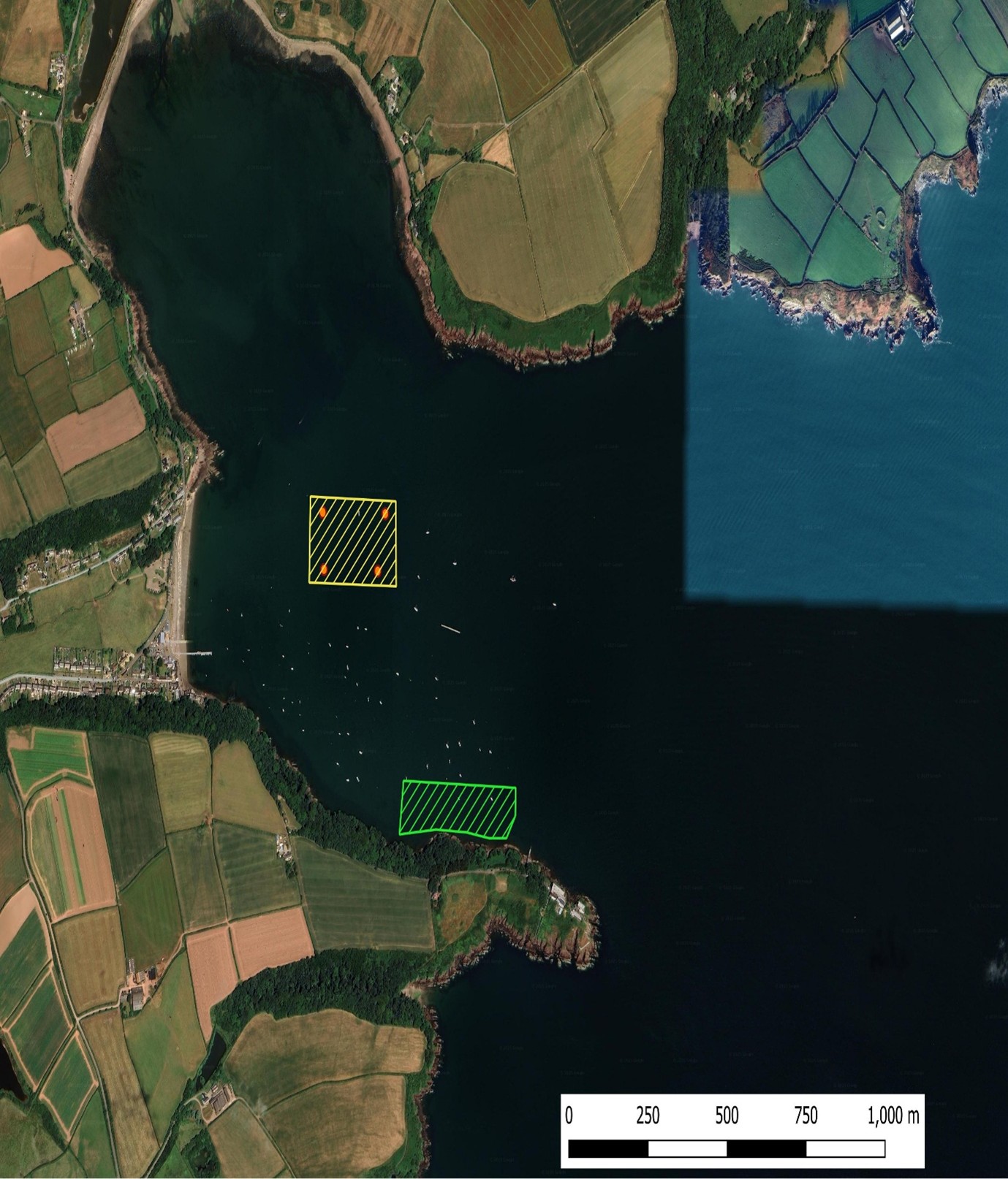
- MARINERS ARE HEREBY ADVISED that diving operations for seagrass surveys and seabed mapping will take place in Dale Bay at position 51°42'17.6"N 005°09'34.9"W from 8th October 2025 to 10th October 2025 (refer to the chartlet attached for operational area).
- Diving operations will be carried out by RV ‘’Lady Gail II ‘’, with transect lines marked by small orange buoys.
- A 2 m remotely operated USV will carry out seabed mapping from the surface, accompanied by RV Lady Gail II within 50 m, and will be retrieved before the vessel leaves the survey areas.
- RV Lady Gail II will display lights and shapes in accordance with COLREGS, Flag A will be displayed whenever divers are in the water. Vessel will remain in contact with Milford Haven VTS and always monitor VHF Ch. 12.
- Mariners are requested to navigate with caution, pass at a safe speed, and maintain a safe distance when operating in the area.
- Admiralty Charts 3274, 3275, IMRAY Y26, and 2600 Atlas refer.
- This Notice to Mariners will self-cancel at 23:59 on 10th October 2025.
BY ORDER
M RYAN
HARBOURMASTER
Port of Milford Haven
Gorsewood Drive
Hakin
Milford Haven
Pembrokeshire
SA73 3EP
Tel: 01646 696100
Email: enquiries@mhpa.co.uk